
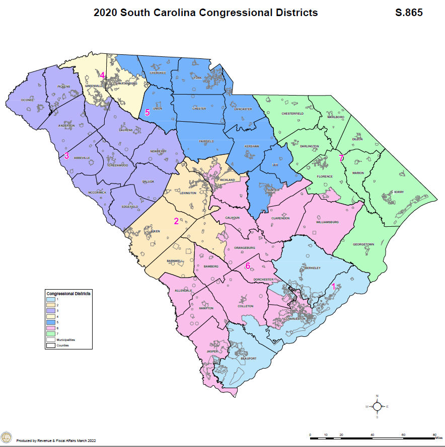
For an interactive ArcGIS map, please click this link.
District 1: Beaufort, Berkeley, parts of Charleston, parts of Colleton, parts of Dorchester, parts of Jasper
District 2: All of Aiken, Barnwell, and Lexington, and parts of Orangeburg and Richland
District 3: All of Oconee, Pickens, Anderson, Abbeville, Laurens, Greenwood, McCormick, Newberry, Edgefield, Saluda, and parts of Greenville
District 4: Parts of Spartanburg and parts of Greenville
District 5: All of Cherokee, York, Union, Chester, Lancaster, Fairfield, Kershaw, and Lee, and parts of Spartanburg and Sumter
District 6: All of Allendale, Hampton, Jasper, Bamberg, Calhoun, Clarendon, and Williamsburg, and parts of Colleton, Charleston, Dorchester, Orangeburg, Richland, Sumter, and Florence
District 7: Chesterfield, Marlboro, Darlington, Dillon, Marion, Horry, and Georgetown, parts of Florence